Weekly Report
Note: This will be the last report update that will be provided. We’ve loved every minute of this journey and value the relationships we’ve made and the community that we’ve built but unfortunately, it’s time for us to focus on other priorities. Flows on the Middle Colorado, near Pumphouse, have come down steadily in recent days due in part to reduced outflow from Green Mountain Reservoir. As a result, trout are becoming increasingly skittish and selective so you’ll need to practice stealth and presentation. Water clarity is good and trout are on high alert. However, they are fairly sluggish in the early hours of the day. Tried and true nymph rigs with a searcher or attractor at the lead to one or more smaller imitative patterns will do most of the heavy lifting. Midge and baetis imitations will offer the most bang for your buck, but don’t neglect those stonefly, leech, worm or caddis patterns as well. Trout are holding along the banks, slack water, outer seams, slow runs/pools and pockets at various times throughout the day. In the early hours, or absent hatch activity, stick to the banks and soft water. Otherwise, hit the more pronounced water upon hatch activity. Hatch activity has been consistent with midges making a regular appearance in late morning and early afternoon as well as the occasional BWO hatch in the late morning/early afternoon. That being said, surface action can be hit or miss, but if you see trout actively rising don’t refrain from rigging up some dry flies. Lastly, streamers are really starting to heat up with the up and coming brown trout spawn. Hit the banks and slow water for the best results.
Recommended Flies
Subsurface
- Zebra Midge (#18-22)
- Money Midge (#20-22)
- Pure Midge (#20-22)
- Mercury Black Beauty (#18-22)
- Splitcase PMD (#16-18)
- Perdimidge (#18-20)
- Chocolate Foam Back Emerger (#18-22)
- Mercury RS2 (#18-22)
- Stalcup's Baetis (#18-22)
- Electric Caddis (#16-18)
- Sparkle Pupa (#16-18)
- Yellow Sally nymph
- Woven Stonefly nymph
- Pat's Rubber Leg (#8-12)
- Mayer's Mini Leech (#12-14)
- Gold Ribbed Choice Hare's Ear (#16-18)
- Psycho Prince Nypmh (#18-20)
- Flashback Pheasant Tail (#18-20)
- Perdigon (#16-18)
- Rainbow Warrior (#18-20)
- San Juan Worm
- Pig Sticker
Surface
- Parachute Adams (#18-20)
- Cluster Midge (#20-24)
- Griffith's Gnat (#20)
- ParaWulff (#18)
- Parachute BWO (#20-22)
Streamers
- Slump Busters (#4-6)
- Sculpzilla (#4 or #8)
- Peanut Envy (#4)
- white Sparkle Minnow (#6)
- black Wooly Bugger (#4-6)
- Cheech Leech (#6)
- Barely Legal (#4)
Need flies for your trip? FlyCast has collaborated with our friends at Anglers All to package a dozen flies that are hot on the Colorado River Basin, right now - Click here for hand selected flies
River Flow
Detailed River Info
Background
The Colorado River, which flows through seven US states and two Mexican states originates in Colorado's Rocky Mountain National Park. There are three sections of river as it pertains to the state of Colorado, the Upper, Middle and Lower. The middle section begins in Gore Canyon near Kremmling and flows southwest to the town of Dotsero, six miles west of Gypsum off of I-70. On this picturesque stretch of river you'll find numerous Brown and Rainbow Trout as well as Rocky Mountain White Fish (or Whities). While this freestone river does experience its share of crowds especially near the Pumphouse access point and through Gore Canyon, solitude is just a float away.
Angling
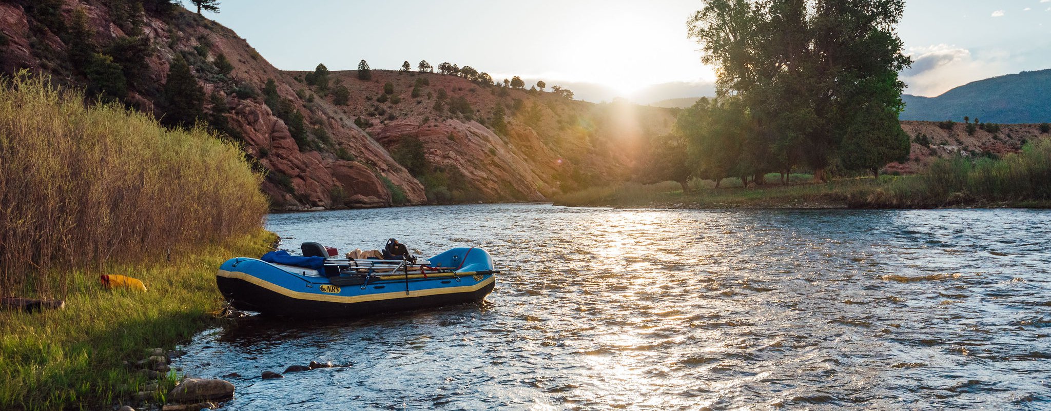
The Middle Colorado is great for anglers of all skill sets and preferences. While wading is certainly a option through Gore Canyon down to Needle Eye, you will be restricted to the banks for the most part. The stretch between Gore Canyon and Rancho Del Rio is generally the most busy as it offers a number of camping and entertainment options. That being said, it holds sizable trout and is a great float. If you're fortunate enough to float, we high recommend it. Fishing via raft is one our favorite ways to go as you can cover a lot of ground in a short period of time and access water only accessible by boat. We like to pull the boat out from time to time and fish that low pressure water or to enjoy a beverage. After Gore Canyon and depending on flows, you're looking a very manageable and fishing friendly float. For the most part you'll be dealing with class II water with the occasional class III rapid. This is a great river to learn how to row as there are minimal consequences and the water is generally forgiving. However, if you've never been behind the oars, we recommend learning from an experienced rower.
River Access
There are a number of access points along the middle Colorado. Arguably, the most popular is at Pumphouse. Traveling from Denver, take I-70 West to Silverthorne then head north on Highway 9. Take CO-9 N roughly 35 miles to County Road 1(Trough Road), just before you reach Kremmling. From there you will take County Road 1 for 15 miles until you've reached the Pumphouse access road. If you plan on starting below Rancho Del Rio, we recommend passing Silverthorne and taking I-70 until you've reached the town of Wolcott just past the town of Edwards. From there you will take Colorado State Highway 131 until you reach the water.
Float Options:
- Pumphouse to Radium - 4 miles
- Radium to Rancho Del Rio - 5 miles
- Rancho Del Rio to State Bridge - 4 miles
- State Bridge to Two Bridges - 6 miles
- Two Bridges to Catamount Bridge - 8 miles
- Catamount Bridge to Burns - 5 miles
- Bruns to Pinball - 4 miles
- Pinball to Cottonwood - 14 miles
- Cottonwood to Dotsero - 6 miles