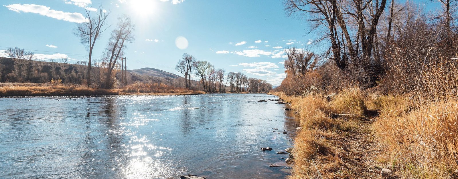
Weekly Report
Note: This will be the last report update that will be provided. We’ve loved every minute of this journey and value the relationships we’ve made and the community that we’ve built but unfortunately, it’s time for us to focus on other priorities. Flows on the Upper Colorado, near Parshall, have held steady in recent days and remain at a healthy and productive level. Water clarity and visibility are good, but there is a slight hue to it, which should work in your favor. Either way, do your best to sight fish. You can expect the mornings to be comparatively slow and for trout to hold idle in the soft water during the coldest hours of the day. At this point, nymphing with a moderate sized lead fly in the searcher/attractor variety to one or more smaller midge or baetis imitations is the name of the game. Hatch has been fairly consistent with midges making a regular appearance as well as a few lingering BWOs. Surface action can be hit or miss, however, but if you see trout actively rising don’t hesitate to rig up some dry flies. Either way, a dry dropper or hopper dropper is a viable and productive option right now. Lastly, streamers have been and will continue to be an effective route given brown trout spawn activity. Hit the banks and slow water for the best results.
Recommended Flies
Subsurface
- Pure Midge (#20-22)
- Zebra Midge (#18-22)
- Mercury Black Beauty (#18-22)
- Top Secret (#18-24)
- Chocolate Foam Back Emerger (#18-22)
- RS2 (#18-24)
- Stalcup's Baetis (#18-22)
- Pat's Rubber Leg (#8-12)
- Pine Squirrel Leech (#10-12)
- Gold Ribbed Hare's Ear (#18-20)
- Psycho Prince Nymph (#18-20)
- Flashback Pheasant Tail (#18-20)
- Perdigon (#16-18)
- Rainbow Warrior (#18-20)
- San Juan Worm
Surface
- Parachute Adams (#20-22)
- Matt's Midge (#20-22)
- Cluster Midge (#20-24)
- Griffith's Gnat (#20-22)
- Parachute PMD (#14-16)
- Green Drake (#14-16)
- Elk Hair Caddis (#14-18)
- Chubby Chernobyl
- Amy's Ant
Streamers
- Slump Busters (#4-6)
- Sculpzilla (#4 or #8)
- Peanut Envy (#4)
- white Sparkle Minnow (#6)
- black Wooly Bugger (#4-6)
- Cheech Leech (#6)
- Barely Legal (#4)
Need flies for your trip? FlyCast has collaborated with our friends at Anglers All to package a dozen flies that are hot on the Colorado River Basin, right now - Click here for hand selected flies
River Flow
Detailed River Info
Background
The Colorado River, which flows through seven US states and two Mexican states originates in Colorado's Rocky Mountain National Park. There are three sections of river as it pertains to the state of Colorado, the Upper, Middle and Lower. The Upper Colorado is a comparatively large freestone river that originates at the confluence of the Frasier River west of Granby and stretches to the confluence with Troublesome Creek west of Parshall. This picturesque stretch of river, which is lined with cottonwoods and willows, earned its Gold Medal status for its plethora of medium to large sized brown and rainbow trout.
Angling
Fishing on this smooth and meandering section of the Colorado is great for anglers of all skill sets and can be fished most of the year. Feature wise, this section provides everything from shallow riffles and slow runs to deep pools. Nymphing and streamer fishing are both effective, but it is most known for its summer dry fly fishing. During this time, there is an abundance of PMD, Caddis and Stoneflies. However, the Salmon fly hatch is arguably what entices anglers the most.
River Access
There are a number of great public access points. The following access points reference Granby as the starting point.
#1: Roughly 4 miles northwest of Granby on US Hwy 40 is a roadside pull off on the left side of the road with access on either side of the river.
#2: 11 miles west on US Hwy 40 to the Town of Hot Sulphur Springs Pioneer Park. From Hwy 40, turn right on CO Rd 20 then left over the bridge. There is a camping a picnic area that provides over a mile of public water on either side of the river.
#3: 13.1 miles west on Hwy 40 into Byers Canyon there is a parking area on the right hand side of the road and a short trail to the water.
#4: 13.3 miles west on Hwy 40 to the Hot Sulphur Springs State Wildlife Area/Joe Gerrans Area. From Hwy 40 take a left at the east end of the bridge onto CO Rd 50. There is roughly 2,300 acres of water on either side of the river.
#5: 13.4 miles west on Hwy 40 to Hot Sulphur Springs State Wildlife Area/Paul Gilbert Day Area. From Hwy 40 turn left on CO Rd 362. On the right side of the bridge you will find the day use area and a short (1/4 mile) section of public water.
#6: 13.6 miles west on Hwy 40 to Hot Sulphur Springs State Wildlife Area/Lone Buck. From Hwy 40 take a left at the sign for Lone Buck to find camping and a day use area with 2,300 acres of water on either side of the river.
#7: 15. 5 miles west on Hwy 40 to Kemp/Breeze State Wildlife Area. From Hwy 40 take a left on CO Rd 3. The parking lot is 0.7 miles on CO Rd 3 on the right. From there you can take a trail to the Confluence of the Colorado and Williams Fork.